


Large Luftwaffe map of Western France
SOLD
Although this item has been sold, we have a range of similar items that may be of interest to you.
View similar items
Delivery Quote Request
Please fill in the form below to request a delivery quote from The Militaria Dealers.
Contact The Militaria Dealers
 Surrey, United Kingdom
Simply fill in the below form to get in touch with The Militaria Dealers regarding this item.
About this item
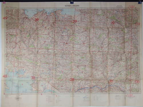
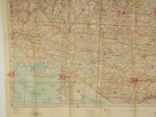
A large size Luftwaffe Map measuring approximately 135cms x 100 cms, headed Fliegerausgarbe (Flyer’s Edition) and Rennes – Angers.
Published by the Luftwaffe general staff in 1942 the Map is in scale 1 -200,000 in a Mercator Projection and is in very good condition with just one small fold hole at the very centre of the Map and one 2.5cmtear along the fold at the border of the map on the left side. It covers a large area from St. Brieuc, St. Malo and Avaranches in the North to St.Nazaire in the South, the Bay of Quiberon in the West and Le Mans in the East.
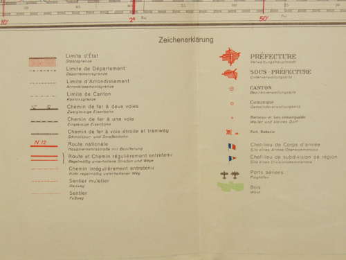
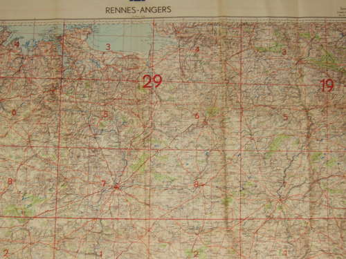
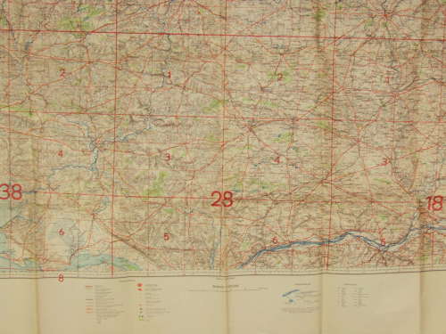
All ground features are shown along with airfields.
An excellent backdrop for a Luftwaffe display
Disclaimer: Items related to the Nazi regime or the Third Reich sold by dealers on this platform are intended solely for educational, historical, or TV/film prop purposes. Militaria Zone does not promote, and is strongly against, the hate ideologies and atrocities committed during WWII.
The law regarding sales of items like this vary depending which country you are in. If in doubt, please check the law in your country.
Additional Information
![]() Surrey, United Kingdom
Surrey, United Kingdom


